


NHC Graphical Outlook Archive
« Earliest Available ‹ Earlier Later › Latest Available »
Place your mouse cursor over areas of interest for more information
| GIS data: .shp |
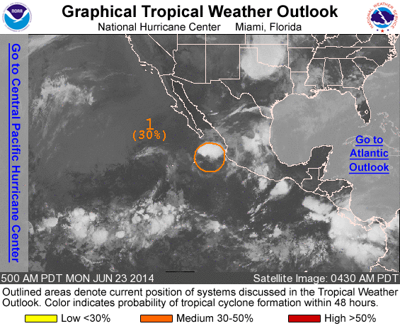
ZCZC MIATWOEP ALL
TTAA00 KNHC DDHHMM

TROPICAL WEATHER OUTLOOK
NWS NATIONAL HURRICANE CENTER MIAMI FL
500 AM PDT MON JUN 23 2014

For the eastern North Pacific...east of 140 degrees west longitude:

1. Disorganized showers and thunderstorms continue in association with
an area of low pressure located a few hundred miles south-southeast
of the southern tip of the Baja California penisula.
Environmental conditions are marginally conducive for development
of this system during the next day or so, but are expected to become
less favorable thereafter while the system slows down and turns
northwestward.
* Formation chance through 48 hours...medium...30 percent.
* Formation chance through 5 days...medium...30 percent.

Forecaster Kimberlain/Pasch
List of all Atlantic Outlooks
List of all East Pacific Outlooks