


NHC Graphical Outlook Archive
« Earliest Available ‹ Earlier Later › Latest Available »
Place your mouse cursor over areas of interest for more information
| GIS data: .shp |
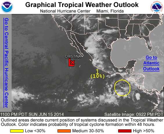
ZCZC MIATWOEP ALL
TTAA00 KNHC DDHHMM

TROPICAL WEATHER OUTLOOK
NWS NATIONAL HURRICANE CENTER MIAMI FL
1100 PM PDT SUN JUN 15 2014

For the eastern North Pacific...east of 140 degrees west longitude:

1. Showers and thunderstorms associated with a tropical wave several
hundred miles south-southeast of the Gulf of Tehuantepec have
decreased this evening.  However, environmental conditions remain
conducive for gradual development of this disturbance during the
next several days as it moves westward and then west-northwestward
at around 10 mph.
* Formation chance through 48 hours...low...10 percent.
* Formation chance through 5 days...medium...30 percent.

Forecaster Kimberlain
List of all Atlantic Outlooks
List of all East Pacific Outlooks