


NHC Graphical Outlook Archive
« Earliest Available ‹ Earlier Later › Latest Available »
Place your mouse cursor over areas of interest for more information
| GIS data: .shp |
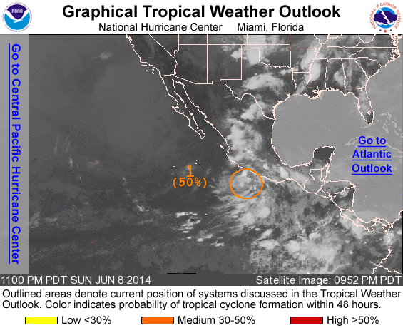
ZCZC MIATWOEP ALL
TTAA00 KNHC DDHHMM

TROPICAL WEATHER OUTLOOK
NWS NATIONAL HURRICANE CENTER MIAMI FL
1100 PM PDT SUN JUN 8 2014

For the eastern North Pacific...east of 140 degrees west longitude:

1. Cloudiness and showers remain disorganized in association with a
broad and elongated area of low pressure located a couple of hundred
miles west-southwest of Acapulco, Mexico.  Environmental conditions
appear conducive for gradual development, and this system will
likely become a tropical depression during the next few days while
it moves generally west-northwestward at 5 to 10 mph.
* Formation chance through 48 hours...medium...50 percent.
* Formation chance through 5 days...high...80 percent.

Forecaster Cangialosi
List of all Atlantic Outlooks
List of all East Pacific Outlooks