


NHC Graphical Outlook Archive
« Earliest Available ‹ Earlier Later › Latest Available »
Place your mouse cursor over areas of interest for more information
| GIS data: .shp |
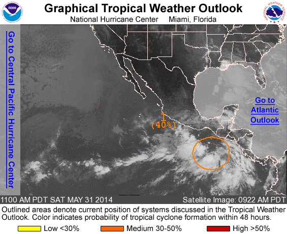
ZCZC MIATWOEP ALL
TTAA00 KNHC DDHHMM

TROPICAL WEATHER OUTLOOK
NWS NATIONAL HURRICANE CENTER MIAMI FL
1100 AM PDT SAT MAY 31 2014

For the eastern North Pacific...east of 140 degrees west longitude:

1. Showers and thunderstorms associated with a broad area of low
pressure located a few hundred miles south-southeast of the Gulf of
Tehuantepec are gradually becoming better organized. Environmental
conditions are expected to become more conducive for the development
of this disturbance during the next few days as it begins to drift
generally northward.  Regardless of tropical cyclone formation, this
system has the potential to produce locally heavy rains over
portions of western Central America and southeastern Mexico this
coming week.
* Formation chance through 48 hours...medium...40 percent
* Formation chance through 5 days...high...70 percent

Forecaster Kimberlain
List of all Atlantic Outlooks
List of all East Pacific Outlooks