


NHC Graphical Outlook Archive
« Earliest Available ‹ Earlier Later › Latest Available »
Place your mouse cursor over areas of interest for more information
| GIS data: .shp |
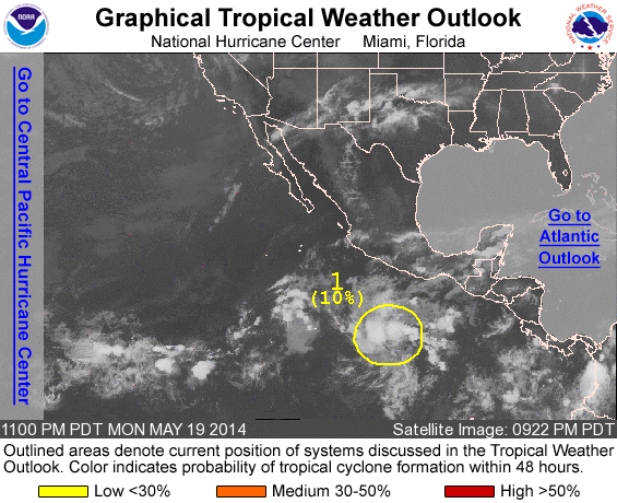
ZCZC MIATWOEP ALL
TTAA00 KNHC DDHHMM

TROPICAL WEATHER OUTLOOK
NWS NATIONAL HURRICANE CENTER MIAMI FL
1100 PM PDT MON MAY 19 2014

For the eastern North Pacific...east of 140 degrees west longitude:

Systems with the potential to become a tropical cyclone during the
next 48 hours...

1. An area of disturbed weather centered about 475 miles south of
Acapulco, Mexico is moving slowly toward the west-northwest.
Environmental conditions appear to be conducive for some gradual
development of this system over the next several days while it
continues to move slowly west-northwestward.
* Formation chance through 48 hours...low...near 10 percent
* Formation chance through 5 days...low...20 percent

Forecaster Avila
List of all Atlantic Outlooks
List of all East Pacific Outlooks