NHC Graphical Outlook Archive (Text)
Standard version of this page
« Earliest Available ‹ Earlier Later › Latest Available »
Place your mouse cursor over areas of interest for more information
Graphical TWO atl
ZCZC MIATWOAT ALL
TTAA00 KNHC DDHHMM
TROPICAL WEATHER OUTLOOK
NWS NATIONAL HURRICANE CENTER MIAMI FL
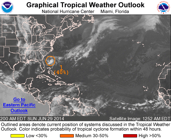
200 AM EDT SUN JUN 29 2014
For the North Atlantic...Caribbean Sea and the Gulf of Mexico:
1. A broad area of low pressure located about 200 miles east of the
coast of Georgia continues to produce disorganized showers and
thunderstorms. Environmental conditions are expected to remain
conducive for gradual development of this system while it drifts
southward offshore of the northeastern and east-central Florida
coast during the next few days. An Air Force Reserve Hurricane
Hunter aircraft is scheduled to investigate this system this
afternoon, if necessary.
* Formation chance through 48 hours...medium...40 percent.
* Formation chance through 5 days...high...60 percent.
Forecaster Pasch
List of all Atlantic Outlooks
List of all East Pacific Outlooks