NHC Graphical Outlook Archive (Text)
Standard version of this page
« Earliest Available ‹ Earlier Later › Latest Available »
Place your mouse cursor over areas of interest for more information
Graphical TWO atl
ZCZC MIATWOAT ALL
TTAA00 KNHC DDHHMM
TROPICAL WEATHER OUTLOOK
NWS NATIONAL HURRICANE CENTER MIAMI FL
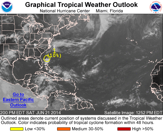
200 PM EDT SAT JUN 21 2014
For the North Atlantic...Caribbean Sea and the Gulf of Mexico:
1. Some showers and thunderstorms have persisted today in association
with a weak area of low pressure located about 200 miles east of
Jacksonville, Florida. However, environmental conditions are not
conducive for development as the low the moves northeastward away
from the United States coast.
* Formation chance through 48 hours...low...10 percent.
* Formation chance through 5 days...low...10 percent.
Forecaster Landsea
List of all Atlantic Outlooks
List of all East Pacific Outlooks