NHC Graphical Outlook Archive (Text)
Standard version of this page
« Earliest Available ‹ Earlier Later › Latest Available »
Place your mouse cursor over areas of interest for more information
Graphical TWO atl
ZCZC MIATWOAT ALL
TTAA00 KNHC DDHHMM
TROPICAL WEATHER OUTLOOK
NWS NATIONAL HURRICANE CENTER MIAMI FL
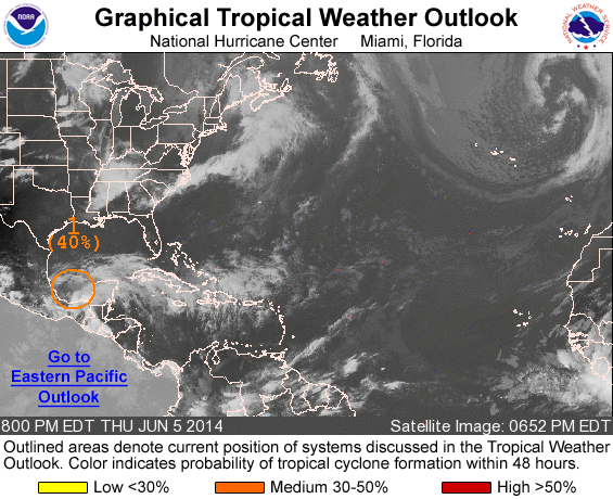
800 PM EDT THU JUN 5 2014
For the North Atlantic...Caribbean Sea and the Gulf of Mexico:
1. A stationary low pressure system located over the southern Bay of
Campeche is producing a large area of cloudiness and showers over
most of the southwestern Gulf of Mexico and adjacent land areas
of southeastern Mexico and the Yucatan Peninsula. Satellite data
indicate winds to near gale force are likely occurring to the
northeast and east of the center, and some development of this
system is still possible over the next day or two while the low
drifts generally northwestward toward eastern Mexico. This
disturbance will continue to produce extremely heavy rains, along
with life-threatening flash floods and mud slides, over portions of
southeastern Mexico during the next few days.
* Formation chance through 48 hours...medium...40 percent.
* Formation chance through 5 days...medium...40 percent.
Forecaster Stewart
List of all Atlantic Outlooks
List of all East Pacific Outlooks