


NHC Graphical Outlook Archive
« Earliest Available ‹ Earlier Later › Latest Available »
Place your mouse cursor over areas of interest for more information
| GIS data: .shp |
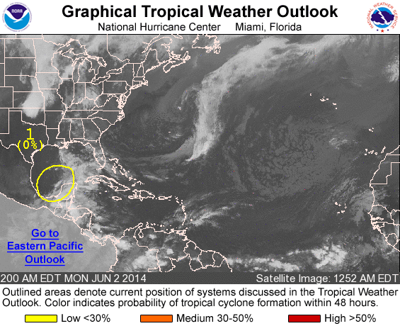
ZCZC MIATWOAT ALL
TTAA00 KNHC DDHHMM

TROPICAL WEATHER OUTLOOK
NWS NATIONAL HURRICANE CENTER MIAMI FL
200 AM EDT MON JUN 2 2014

For the North Atlantic...Caribbean Sea and the Gulf of Mexico:

1. A stationary trough of low pressure interacting with a large
upper-level low is producing widespread cloudiness and disorganized
showers over much of the southwestern and central Gulf of Mexico,
and across the Yucatan Peninsula, portions of southeastern Mexico,
Belize, and northern Guatemala.  Environmental conditions are
currently unfavorable for development, but could become slightly
more conducive later this week as this system moves little.
* Formation chance through 48 hours...low...near 0 percent
* Formation chance through 5 days...low...20 percent

Forecaster Stewart
List of all Atlantic Outlooks
List of all East Pacific Outlooks