000
AXNT20 KNHC 131720
TWDAT
Tropical Weather Discussion
NWS National Hurricane Center Miami FL
1805 UTC Mon May 13 2024
Tropical Weather Discussion for North America, Central America
Gulf of Mexico, Caribbean Sea, northern sections of South
America, and Atlantic Ocean to the African coast from the
Equator to 31N. The following information is based on satellite
imagery, weather observations, radar and meteorological analysis.
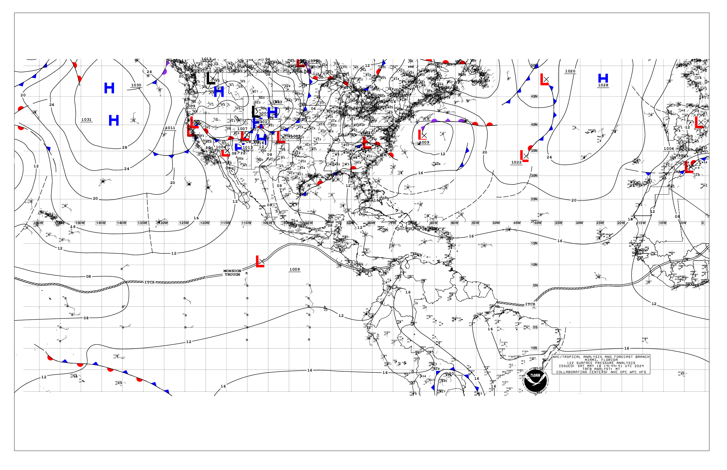
Based on 1200 UTC surface analysis and satellite imagery through
1600 UTC.
...MONSOON TROUGH/ITCZ...
The monsoon trough extends from Senegal near 14N17W to 04N27W.
The ITCZ continues from 04N27W to the coast of Brazil near
02N49W. Scattered moderate convection is noted from 01N to 08N
between 12W and 42W.
...GULF OF MEXICO...
Weak high pressure dominates the Gulf of Mexico. A stationary
front just N of the area over the U.S. is inducing scattered
moderate convection within 90 nm of the coast from Texas to the
Florida Panhandle. Mainly fresh winds dominate the central Gulf,
with moderate winds elsewhere. Seas are 4 to 6 ft in the central
basin and 2 to 4 ft elsewhere.
For the forecast, an inverted trough may develop over the western
Gulf early this week where it may linger through at least mid-
week. Heavy rainfall and thunderstorms are expected across the
northern Gulf over the next few days. Mainly moderate to fresh
return flow will dominate the basin, pulsing to strong near the
Yucatan Peninsula and Yucatan Channel. Meanwhile, haze due to
agricultural fires in Mexico continues across most of the western
Gulf and Bay of Campeche.
...CARIBBEAN SEA...
The pressure gradient between high pressure in the subtropics and
lower pressure over South America is leading to moderate to fresh
trades over much of the basin. Strong SE to E winds are occurring
in the Gulf of Honduras and offshore Colombia. Seas of 5 to 7 ft
are occurring in the areas of strong winds, with 4 to 6 ft seas
elsewhere. Scattered moderate convection is noted in the SW
Carribbean in association with monsoon trough, S of 12N and W of
79W.
For the forecast, high pressure over the central Atlantic will
support strong to near gale E to SE winds near the Gulf of
Honduras, with fresh to strong winds expected in the south-central
basin through most of the week. Seas will build through the week
as a result of the increasing winds. Gentle to moderate winds are
expected elsewhere through most of the week. Meanwhile, haze due
to agricultural fires in Central America continues across some
areas of the northwestern Caribbean.
...ATLANTIC OCEAN...
A cold front has stalled from 31N60W to 27N79W. A pre-frontal
trough is noted from 29N55W to 22N66W. Scattered moderate
convection is associated with these features N of 22N between 50W
and 66W. Moderate to locally fresh winds are noted near the
front mainly north of 28N and between 58W and 68W. Seas in these
waters are 4 to 6 ft. Light to gentle winds and slight to moderate
seas prevail elsewhere west of 50W, while moderate to fresh
easterly winds prevail east of 50W.
The remainder of the tropical Atlantic is dominated by a broad
1030 mb high pressure system centered to the west of the Azores.
The pressure gradient between this ridge and relatively lower
pressures in northwest Africa result in fresh to strong northerly
winds north of 16N and east of 21W. Seas in the area described
are in the 7 to 9 ft range. Elsewhere, moderate or weaker winds
and moderate seas are prevalent.
For the forecast W of 55W, the aforementioned front will weaken
and dissipate by Tue. High pressure will build in its wake. Fresh
to strong southerly winds and building seas are forecast offshore
N Florida by Tue ahead of another possible cold front. That front
may reach from near 31N76W to 27N80W by early Thu, weakening and
stalling from 31N69W to near Fort Pierce, Florida by early Fri.
Conditions around the front will improve by late Fri.
$$
Konarik


